
News Summary
Central Texas is under severe weather alerts, including a Tornado Watch and Flash Flood Warning. Residents are urged to stay alert and seek shelter as severe storms and tornadoes may impact numerous counties. The potential for life-threatening situations prompted local authorities to issue urgent warnings. Reports include severe thunderstorms capable of producing tornadoes moving through the area, heightening the need for preparedness among communities.
Austin, Texas – Central Texas is facing severe weather conditions today, with a Tornado Watch in effect until 10 p.m. on May 26, 2025. This watch has been extended until midnight for several counties in the region, prompting residents to remain alert.
The Tornado Watch encompasses numerous counties, including Bastrop, Blanco, Burnet, Caldwell, Gillespie, Hays, Lee, Llano, Travis, and Williamson. As severe storms continue to develop, a Tornado Warning is currently in place for northeastern Williamson County until 9 p.m., while Bell and Milam counties remain under a Tornado Warning until 9:30 p.m.
In addition to the tornado warnings, a Flash Flood Warning has been issued for Hays, Blanco, Travis, Burnet, and Williamson counties, effective until 1 a.m. on May 27. Moreover, severe thunderstorms are impacting Bell, Milam, and Falls counties until 9:30 p.m., with additional Severe Thunderstorm Warnings active for Travis, Williamson, Hays, and Bastrop counties until 9:45 p.m.
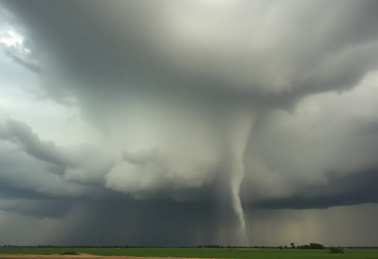
Reports of severe thunderstorms capable of producing tornadoes have surfaced, including one located near Bartlett at 8:49 p.m., moving east at 35 mph. A separate severe thunderstorm was identified over Flugrath near Blanco at 7:34 p.m., traveling east at 25 mph and also having the potential to generate a tornado.
The National Weather Service has categorized the current weather situations as potentially life-threatening, noting the presence of a “large and extremely dangerous” tornado near Streeter, moving southeast at a speed of 20 mph. Communities advised to take immediate cover include Fredericksburg, Cherry Spring, Tivydale, Crabapple, and Doss.
In Mason County, the Tornado Warning has been prolonged until 6:15 p.m., with additional warnings indicating the possibility of golf-ball-sized hail and gusts up to 60 mph from passing storms. Another factor to consider is the forecast of flash flood conditions, which are also applying to parts of Bexar, Comal, and Guadalupe counties, lasting until 3 a.m. the following day. Rainfall has already reached up to 2 inches in northern Bexar County, with an additional 1-3 inches anticipated.
Residents are strongly advised to avoid driving over flooded roadways, as storm conditions continue to worsen. The timing for storm impacts is as follows: Hill Country is expected to experience severe weather between 5 p.m. and 9 p.m., the Austin metro area from 7 p.m. to 11 p.m., and eastern counties from 9 p.m. to midnight.
This weather outbreak is categorized with an enhanced risk of severe storms, highlighting the significant threat of severe weather in the area. Local residents have been actively sharing videos and photographs showcasing the impact of the storms, drawing attention to the severity of current conditions.
The background context for today’s severe weather includes a forecast predicting the development of severe storms earlier in Hill Country, leading to widespread adverse effects across Central Texas. In response to these rapidly changing weather conditions, the National Weather Service urges people to stay informed about the latest updates, prepare for potential emergencies, and take shelter as needed.
Deeper Dive: News & Info About This Topic
HERE Resources
Historic Public School Funding Agreement in Texas
Texas House Approves Display of Ten Commandments in Classrooms
Texas Senate Amendment Alters Medical Marijuana Program
Central Texas Faces Severe Weather and Key Legislation Updates
Lightning Strikes Trigger Dramatic House Fire in Austin
Texas Softball Advances to Game Three After Dramatic Win
Severe Storms Cause Widespread Damage in Central Texas
Hazy Skies and Poor Air Quality in Central Texas
Austin Braces for Extreme Heat Wave
Austin Faces Record-Breaking Heat Wave
Additional Resources
- FOX 7 Austin
- Wikipedia: Tornado
- KXAN Weather
- Google Search: Central Texas Weather
- CBS Austin
- Google Scholar: Severe Weather
- Texas Storm Chasers
- Encyclopedia Britannica: Severe Weather
- Statesman
- Google News: Tornado Watch Texas