
News Summary
Central Texas faced severe storms resulting in extensive damage, particularly in counties like Mason, Llano, and Hays. Baseball-sized hail was reported, along with wind gusts exceeding 60 mph, causing disruptions to local events, including high school graduations. With further storms anticipated, residents are urged to remain vigilant as conditions evolve, with predictions of a cold front bringing additional severe weather on the horizon.
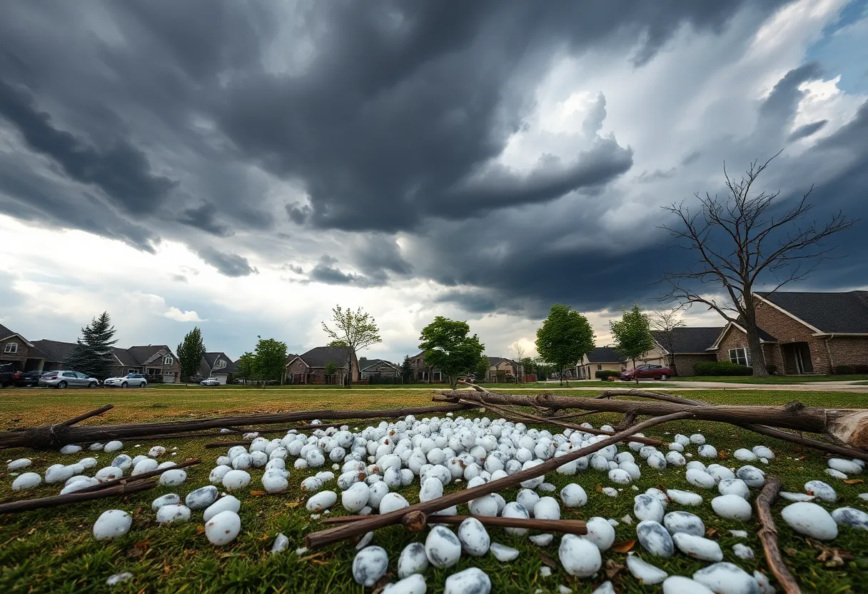
Central Texas experienced severe storms on Thursday evening and night, unleashing baseball-sized hail and causing extensive damage across multiple counties. The storms initially hit Mason and Llano Counties, bringing heavy rain and extreme hail, followed by subsequent thunderstorms in Hays and Caldwell Counties that compounded the damages.
Significant damage was reported, particularly on the east side of San Marcos, Martindale, Maxwell, and surrounding regions including Kyle, Uhland, Niederwald, and Mustang Ridge. Winds gusting over 60 mph were recorded, leading to planes being flipped at the San Marcos airport. In Gillespie County, the community of Stonewall was also impacted with baseball-sized hail, reflecting the intensity of the storms.
After a temporary lull, additional storms approached from the northwest, prompting further severe weather warnings for the Hill Country. San Saba County experienced particularly heavy rains, with 3.2 inches recorded in just half an hour, illustrating the extreme rainfall associated with these storms. Several severe thunderstorm warnings were issued for the Hill Country and the southern area of the Austin metropolitan region, as the conditions warranted close monitoring to ensure public safety.
The impact of the severe weather extended beyond property damage; local high school graduation ceremonies were disrupted by the storm, necessitating adjustments to scheduled events. Residents in affected areas submitted numerous images depicting the large hail and unique mammatus clouds, which often form beneath thunderstorms and can appear as pouches on the cloud’s underside. These vivid formations added to the dramatic nature of the storm event.
Storms were expected to continue sporadically into Friday evening, with forecasters predicting a 30% chance for additional rain and thunderstorms. The weekend outlook indicates mostly sunny conditions on Friday and Saturday, with temperatures climbing into the upper 90s and potentially nearing the 100-degree mark. However, meteorological patterns suggest the possibility of renewed storms on Sunday, particularly late in the day, with a modest 10% chance of precipitation.
Looking ahead, a cold front is anticipated to advance southward from North Texas into Central Texas on Memorial Day, which may trigger more storms and adds to the area’s history of severe weather during this holiday weekend. Throughout the week leading up to the storms, several counties had been under various weather warnings and watches due to unpredictable weather conditions. Earlier in the week, tornado warnings were also issued, with reports confirming at least one tornado in Cameron, underscoring the volatile nature of the recent weather system.
In summary, the severe storms that swept through Central Texas caused significant damage across several counties, with baseball-sized hail reported in multiple locations. Residents are advised to remain vigilant as forecasts predict continued storm activity through the weekend, as the region braces for a potential influx of severe weather in the coming days.
Deeper Dive: News & Info About This Topic
HERE Resources
Austin Faces Historic Heat Wave with Record Temperatures
Austin Prepares for Early Heat Wave
Central Texas Prepares for Extreme Heat Next Week
Severe Weather Hits Central Texas with Tornado Warnings and Flooding
Severe Weather Hits Central Texas
Severe Storms Cause Flight Disruptions and Flooding Risks Across Texas
Central Texas School Districts Adjust to Severe Weather Risk
Round Rock High School Hosts Bowie High School in Playoff Match
Severe Storms Leave Heartbreak and Destruction Across Multiple States
Austin’s Energy Infrastructure Faces Critical Demands
Additional Resources
- KXAN: Severe Storms in Central Texas
- Wikipedia: Severe Weather
- FOX 7 Austin: Tornado Watches in Austin
- Google Search: Tornado Warnings Texas
- KVUE: Severe Weather Forecast Austin
- Google Scholar: Severe Weather Forecasting
- MSNBC: Texas vs Clemson Weather Delays
- Encyclopedia Britannica: Lightning
- KVUE: Austin Weather Rain Chances
- Google News: Central Texas Storms